675 rue Tait, Montréal

A single-family home (2 storeys), built in 1953, on a 372 m² lot. 2 building permits since 1990. Du Collège metro station is 770 m away. Newer than 63% of the buildings on rue Tait. Assessed higher than 77% of the houses and plexes on rue Tait.

Data as of October 29, 2026 · updated every week

Assessed, 2026 roll
$856,200
Welcome tax on that value
≈ $12,473
Dwellings
1
Built
1953

One-time payment, no subscription · PDF for your broker and notary · Secure payment with Stripe

What stands out about 675 rue Tait

Compared with every address on the island of Montréal, from the assessment roll, Montréal open data and the STM timetable.

Street view

Google Street View, loads when you click

What the records show for 675 rue Tait

Note

No short-term rentals to tourists in this borough

Free preview
What the record says
The City of Montréal does not allow renting a home to tourists for short stays in Saint-Laurent, even your principal residence.
What it means
Do not count on short-term rental income from this property unless you will live in it.
What to do
Check the City’s current rules on montreal.ca before you count on rental income.

The full report explains every finding like this one.

Note

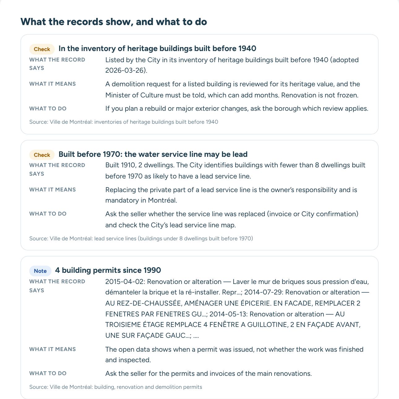
2 building permits since 1990

What it means and what to ask
Note

Assessed at $856,200, +13% on the previous roll

What it means and what to ask
Clear

No notice of deterioration

Clear

No City right of first refusal

Clear

No heritage protection found

Clear

City test: water service line not lead

Clear

Not in a mapped flood zone

Part of a full report: what each record says, what it means and what to do

What the full report adds to each finding

  • What the record says, with its date and number
  • What it means for a buyer
  • What to ask the seller, your broker and your notary
  • The source of every line
See a sample report
Read every record and what to do next
Each finding explained, the full permit history, questions for the seller and the notary, and a PDF for your broker.
 Unlock full report for $20 CAD

Assessed value of 675 rue Tait

In the full report
2026-2028 roll$856,200
Previous roll$757,700
Roll in force in 2022$537,400

From $537,400 on the roll in force in 2022 to $856,200 on the current roll: +59%.

Welcome tax estimated with the City of Montréal’s 2026 brackets on the assessed value; the notary calculates it on the higher of the price and the adjusted value.

The building

UseResidential
Storeys2
Lot area372 m²
TypeDetached
Land use in the urban planResidential
Built area on the lot (City outlines, 2016)≈ 117 m²
Share of the lot under buildings≈ 31%
Frontage, cadastre and owner since

Permits for this address · 2 since 1990

In the full report
Oct 2013 · Certificate of authorization
1 more permit in the full report

Street and trees

City trees in frontNone recorded
BoroughSaint-Laurent
City plan for the pipes under the street (2023–2027)Water main: no work needed · sewer: no work needed · storm sewer: no work needed
Water main breaks repaired within 35 m (1972–2017)1, the latest in 1990

Metro and bus near 675 rue Tait

Nearest metro: Du Collège (Orange line)770 m
du Collège / Lindsay · 128197 m
du Collège / Lindsay · 128214 m
de l'Église / Marcel-Laurin · 16, 128218 m
To downtown (McGill station) by metro and bus, weekday morning≈ 37 min

Public schools near 675 rue Tait

French-language public elementary schoolÉcole Cardinal-Léger, 370 m
English-language public elementary schoolÉcole Gardenview, 790 m
French-language public secondary schoolÉcole Saint-Laurent, 350 m
English-language public secondary schoolAcadémie LaurenHill, 920 m

The nearest school of each kind in a straight line, not the school of the address: each school service centre (French) and school board (English) sets its own territories, so ask it. English public schools require a certificate of eligibility under the Charter of the French language. Source: Ministère de l’Éducation du Québec.

Building activity nearby

Construction permits within 300 m, 2 years0
Demolition permits within 300 m, 2 years0

In Saint-Laurent, the borough issued 22 construction permits and 1 demolition permit in the last two years. About the borough

Life around 675 rue Tait

City 311 requests within 150 m, last 12 months43 · streets, sidewalks and lights 16, snow clearing 12, trees 11
Ground-floor shops within 500 m22 · restaurants and cafés 5, grocery and daily shops 9, other shops 1, services 6, bars, entertainment and hotels 1
Empty storefronts within 500 m19%
Nearest food shopDépanneur Saint-Louis, 360 m
Playground340 m
Dog run220 m
Public poolParc Chamberland, 660 m
Wading pool or splash padParc Gohier, 280 m
Outdoor skating rink260 m
Tennis or pickleball courts270 m
LibraryBibliothèque du Vieux-Saint-Laurent, 910 m

Ville de Montréal open data: 311 requests are counted around the address, never tied to one home; shops come from the City’s survey of ground-floor commercial premises; distances are in a straight line.

The neighbourhood in the 2021 census

People in this census area (2021)808
Median age39.2 (island of Montréal 39.6)
Median household income (2020)$95,000 (island of Montréal $66,500)
Households that own their home72% (island of Montréal 42%)
Moved here in the last five years29% (island of Montréal 44%)
Children under 1517% (island of Montréal 15%)
People 65 and over14% (island of Montréal 18%)
People who speak French and English70% (island of Montréal 60%)
People who speak French only12% (island of Montréal 25%)
Adults 25 to 64 with a bachelor’s degree or higher62% (island of Montréal 45%)
Workers who take transit to work20% (island of Montréal 26%)
Homes that are single-detached houses12% (island of Montréal 14%)
Homes in buildings of five storeys or more0% (island of Montréal 15%)
Homes built in 1960 or before54% (island of Montréal 35%)

Figures for the census dissemination area that contains the address (a few blocks, usually 400 to 700 people), with the whole city in brackets. Source: Statistics Canada, 2021 Census of Population.
Crime near 675 rue Tait

In the full report

In the full report: incidents reported to the SPVM within 300 m over the last 12 months, by type.

Questions about 675 rue Tait

What is 675 rue Tait assessed at?

$856,200 on the 2026-2027-2028 assessment roll. The previous roll had it at $757,700. More

How much is the welcome tax for 675 rue Tait?

About $12,473 on its assessed value of $856,200. The tax is calculated on the highest of the price paid, the value in the deed and the adjusted assessed value, so the real amount may be higher. More

How has the assessed value of 675 rue Tait changed?

From $537,400 on the roll in force in 2022 to $856,200 on the current roll: +59%. The previous roll had it at $757,700. More

When was 675 rue Tait built?

In 1953, according to the assessment roll.

How many dwellings does 675 rue Tait have?

1 dwelling, according to the assessment roll.

Is 675 rue Tait in a flood zone?

No. It is not in a flood zone mapped by the Quebec government. More

Does 675 rue Tait have a notice of deterioration?

No. The Ville de Montréal has registered no notice of deterioration on this building. More

Is 675 rue Tait a heritage building?

No. It is not listed or protected as heritage by the City. More

Can 675 rue Tait be rented short term (Airbnb)?

No. The City of Montréal does not allow short-term rentals to tourists in this borough, even in a principal residence. More

What building permits has 675 rue Tait had?

The City has issued 2 permits since 1990. The latest, from Oct 2013: me modifications extérieures. More

How far is the nearest metro station from 675 rue Tait?

Du Collège is 770 m away in a straight line.

How long does it take to get downtown from 675 rue Tait?

About 37 minutes by metro and bus on a weekday morning to McGill station, with the walk to the stop, according to the STM timetable.

Other addresses on rue Tait

Compare 675 rue Tait with another address · Watch this address: email me when its records change

Full reportEvery record explained · PDF
 Unlock $20

Checked against Montréal open data and the Quebec assessment roll on October 29, 2026. Lot outlines come from the City’s assessment units and have no legal value; the certificate of location decides.